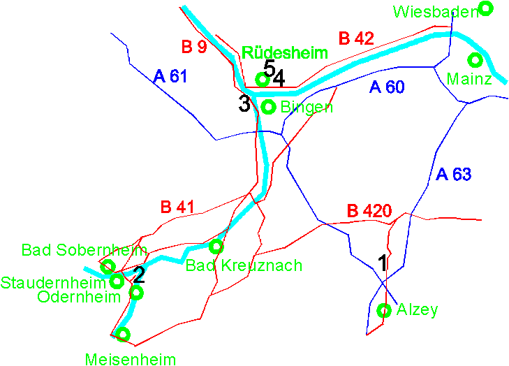
Map of the Historical Sites

- Bermersheim vor der Höhe (signpost "Taufkirche")
A 61 [= E31] exit for Alzey (southern of AB-interchange Alzey); B 271 in direction to Wörrstadt,
until exit on the left side for Flonheim, Lonsheim. In Bermersheim, follow the signpost, please.
- Disibodenberg (signpost "Convent Ruin Disibodenberg")
A 61 [= E31] exit (Nahedreieck), new B41 in direction to Bad Kreuznach -
(Idaroberstein-Saarbrücken) exit for Waldböckelheim, then in direction to Staudernheim-Odernheim/Glan,
and there follow the signpost, please. 900 m through the forest, car park for coachs and cars.
- Bingen/ Bingerbrück (signpost "Rochusberg" and "Rupertsberg")
A 61 [= E31] exit for Bingen, B 50 / B 9 in direction to Koblenz. In Bingen follow the signpost, please.
- Rüdesheim/ Eibingen (signpost "Wallfahrtskirche Eibingen"
- and "Abtei St. Hildegard")
From the direction of Wiesbaden: A 66, then B 42 until Rüdesheim. In Rüdesheim
, follow the signpost, please.
Coming from Bingen: In the town centre of Bingen car ferry Bingen-Rüdesheim. In
Rüdesheim, follow the signpost, please.
Historical Sites

